It is of utmost importance that every ship keeps up to date information that will affect the passage of the ship. The most important information to vessels is information related to safety including Maritime Safety Information. Maritime Safety Information includes navigational and meteorological warnings, meteorological forecasts, warnings about dangers to navigation, warnings of missing vessels and other urgent messages pertaining to the safety of the vessel and its crew.
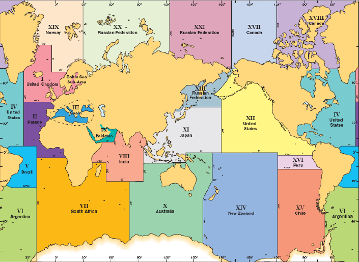
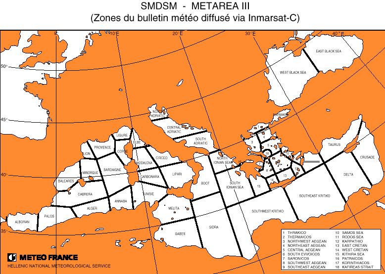
.The NAVTEX system provides all ships with up to the minute information automatically. The area covered by Navtex can extend as far as 400 nautical miles from the broadcast station. A NAVTEX receiver onboard prints out navigational and meteorological warnings and forecasts as well as urgent Marine Safety Information to ships. It forms a vital element of the Global Maritime Distress Safety System (GMDSS). Navtex uses the feature of radio telex or Narrow Band Direct Printing (NBDP) for the automatic broadcast of information. Navtex works on a frequency of 518 kHz in the medium frequency band. 490 kHz frequency is also used by some countries for broadcasts in the national languages, also known as national navtex.The entire world is divided into 21 areas known as NAVAREAS (see the charts below) for the purpose of distributing this information.
The Navtex receives the following kind of messages which you can see on the live Navtex feed below.
A= Navigational Warning B= Meteorological Warning C= Ice report D= Search and Rescue Information/ piracy and robbery
E= Meteorological forecast F= Pilot messages G= AIS messages(formerly Decca messages) H= Loran C messages
I= Omega messages J= Satnav messages (GPS or GLONASS) K= Other electronic navigational aid system messages
L= navigational warnings (additional) M to U= Reserve V= Notice to fisherman W to Y= Reserve
Latest Navtex messages from Cyprus Radio & Others


